
Irrigation water quality can change between the source and the field. For large agricultural districts with multiple canals, relying only on manual inspection makes it difficult to identify abnormal water conditions across the entire irrigation network.
At a large agricultural irrigation district in Yancheng, Jiangsu, a distributed agricultural irrigation water quality monitoring system was deployed at irrigation entrances and key canal locations.
The project established a simple monitoring chain:
Irrigation Water Source → Canal Monitoring → Monitoring Buoy → 4G → Monitoring Center → Irrigation Safety
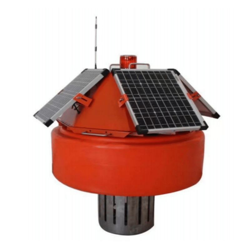
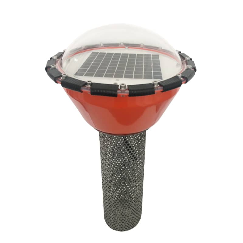
Instead of sending operators to inspect each canal, the system continuously collects water quality data and sends it to a central platform for irrigation management.

The Challenge: Monitoring Water Across a Large Irrigation Network
The main challenge was not measuring water quality at one location. It was obtaining consistent data from multiple dispersed water points.
Traditional field inspection could not provide continuous, large-area monitoring. Changes in water quality therefore depended heavily on manual observation and experience, creating potential risks for soil and crop management.
The project selected key locations such as:
irrigation water entrances → main canals → critical distribution points
This allowed water quality to be checked before potentially unsuitable water was distributed further into the agricultural area.
Monitoring Buoys Bring Sensors Directly to the Canal
Integrated water quality monitoring buoys were deployed at selected canal locations.
The stations continuously monitored parameters including:
These parameters provide operators with data for identifying changes in irrigation water conditions rather than relying only on visual inspection.
Because irrigation canals are open and monitoring points can be widely distributed, the stations combine water quality sensors, solar power and 4G wireless communication. This reduces dependence on fixed power and extensive communication cabling.
The field architecture is therefore:
Canal → Water Quality Sensors → Monitoring Buoy → Solar Power + 4G
From 4G Data to Centralized Irrigation Management
Once collected, monitoring data is transmitted through 4G to a centralized monitoring center.
Operators can review multiple canal monitoring points from one platform instead of repeatedly traveling between distant sites. When water quality changes, the monitoring data helps identify the affected location and supports faster irrigation decisions.
The management logic becomes:
Continuous Monitoring → Data Transmission → Abnormality Detection → Irrigation Decision
This is particularly useful for large irrigation districts where monitoring stations may be separated by considerable distances.

From Water Monitoring to Irrigation Safety
The value of the project is not simply displaying COD, ammonia nitrogen or turbidity readings. The monitoring network gives irrigation managers better visibility before water reaches a larger agricultural area.
According to the project records, the system reduced dependence on manual canal inspections and helped shift irrigation management from experience-based observation toward data-supported decisions.
The complete operating chain can be summarized as:
Irrigation Water Source
↓
Canal Monitoring
↓
Multiparameter Monitoring Buoy
↓
Solar Power + 4G Transmission
↓
Central Monitoring Center
↓
Water Quality Assessment
↓
Safer Irrigation Decisions
For agricultural irrigation projects, the monitoring configuration should be selected according to the water source, canal network, target parameters, number of monitoring points, power availability and communication conditions.
This distributed architecture can be adapted to irrigation canals, agricultural reservoirs, ponds and other open-water monitoring locations.
Planning an Agricultural Irrigation Water Quality Monitoring Project?
Planning an Irrigation Water Quality Monitoring Project?
APURE can help configure monitoring points, water quality sensors, floating stations, wireless transmission and centralized monitoring for agricultural irrigation projects.
Request a Quotation
Send the number of monitoring points, required parameters, canal conditions, project location and communication requirements.
Request a QuotationSend Irrigation Water Data for Design
Provide available COD, ammonia nitrogen, turbidity data, water-source information and required monitoring coverage.
View Multiparameter Monitoring →Contact for Engineering Solution
Discuss buoy deployment, solar power, 4G transmission, sensor selection and centralized monitoring for your irrigation network.
Contact APURE Engineering →